Climate change: Map shows areas to be ‘below sea level’ in 2100
We use your sign-up to provide content in ways you’ve consented to and to improve our understanding of you. This may include adverts from us and 3rd parties based on our understanding. You can unsubscribe at any time. More info
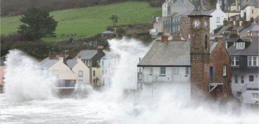
Global sea levels have been steadily rising for years. Unless we slow down this trend, scientists warn vast swathes of the UK could be completely submerged by 2100. A shocking flood map reveals which parts of the UK and the rest of the world are most at risk from rising sea levels.
The rate at which sea levels have been rising has sparked alarm.
According to research by climate.gov, in 2020 global sea levels reached a record high of 3.6 inches above levels in 1993.
The rate of this rise has been climbing at an unsustainable level. It has more than doubled throughout most of the 20th century, from 0.06 inches per year to 0.14 inches per year.
Top of the agenda at the UN COP26 Climate Change conference this year is how to limit global warming to 1.5C by 2100.


Scientists warn the Earth will not cope if this temperature is exceeded.
Current projections from the United Nations Intergovernmental Panel on Climate Change (IPCC) reveal that a further 15-25cm of sea-level rise is expected by 2050, unless drastic action is taken.
IPCC’s report – which is written by 234 scientists from 66 countries – makes for sobering reading.
But it stresses that humanity’s actions can still make an impact to reverse the Earth’s worrying course.

Ko Barrett, IPCC vice-chair said: “We know that there’s no going back from some changes in the climate system.
“However, some of these changes could be slowed and others could be stopped by limiting warming.”
NASA’s Sea Level Change Team has mapped which areas will be flooded by rising sea levels based on the IPCC’s report.
Which areas will be submerged if temperatures rise by 2.7°C?
According to the IPCC, if emissions continue on their current track, with “no additional climate policy” being introduced, the Earth’s temperature will rise by an estimated 2.7C degrees by 2100, according to the IPCC.

If that happens, 19 coastal towns in the UK will be impacted by sea level rises, according to Nasa’s seal level projection tool.
Areas such as Felixstowe, Belfast, Portsmouth, Devonport, Holyhead, Aberdeen, North Shields, and Lerwick in the Shetland Isles will be impacted by sea-level rises.
All 19 towns will see a sea-level rise of at least 0.38cm, enough to breach many flood defences, while the highest rise is forecast to hit Milford Haven in Wales and Immingham in Lincolnshire.
If current trends continue the total sea-level rise will reach an alarming 0.59m in Milford Haven and Immingham.
Worryingly some other reports suggest sea level rises could be higher still.
The Scientist suggests that global warming of over two degrees could be enough for Greenland’s ice sheet to melt.
This would cause sea levels to rise by more than two metres globally causing much more of the UK to be submerged.
Source: Read Full Article


