A 72-year-old man has died after attempting to cross a flooded roadway on foot in the NSW region of Northern Rivers, as weather conditions worsen in the state’s north.
NSW Police were called to Coaldale, about 35 kilometres north of Grafton, on Thursday following reports a man had gone missing in the water. The man is yet to be formally identified.
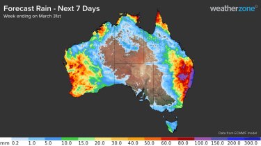
The final week of March is looking very wet for parts of eastern, western and northern Australia.Credit:Weatherzone’s Ben Domensino.
His death came as residents in flood-prone areas, particularly in the state’s north, were urged to enact an evacuation plan ahead of more heavy rainfall.
With thunderstorms expected to bring floods to the Northern Tablelands and the North West Slopes in the coming days, the SES moved more crews into the area and activated an incident management team in Grafton.
“The Australian Defence Force (ADF) are continuing to provide assistance, including moving over 200,000 sandbags and other equipment to the NSW SES warehouse [on Wednesday], in readiness for use across the state,” the NSW SES said in a statement on Friday.
“Additional field response capability, including flood rescue and storm damage teams are also being deployed, supported by additional resources from our partner agencies.”
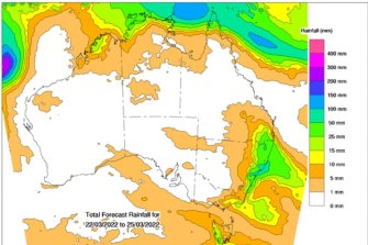
There are major flood warnings in place for the Narren River and a moderate flood warning in place for the Culgoa River. Minor flood warnings are also in place for properties along the Bellinger, Nambucca and Severn rivers from Friday into this weekend, and for the Wollombi Brook in Bulga and both the Birrie and Bokhara rivers.
There is a major flood warning in place for the Narren River and a moderate flood warning in place for the Culgoa River.Credit:Bureau of Meterology
Weatherzone meteorologist Joel Pippard said the state’s Mid North Coast and the Northern Rivers area would be the hardest hit on Saturday by the current weather system.
“With up to 40 millimetres a day for four days in a row expected; that builds up to a flood risk,” he said.
“We are just at the start of this event. In that inland area, in particular, it’s still very saturated, those inland rivers take a lot longer to go down and are much slower than coastal rivers.”
The rainfall comes as a result of two systems moving across NSW – an inland trough and a developing coastal trough.
Mr Pippard said residents in the state’s north should prepare for action.
“If you’re in a flood-prone area, prepare for flooding especially if you know you’re particularly susceptible,” he said.
“Pay attention to the warnings and then also enact a back-up plan if things go south.”
Sydney is expected to receive 25mm of rain on Friday before 10mm on Saturday. On Sunday, the harbour city is set to be hit up to 30mm of rain before 15mm each on both Monday and Tuesday.
“This event is not quite over yet, it is another prolonged one,” Mr Pippard said.
“And while we’re not expecting those huge downpours it will still lead to some flooding and aggravated conditions for a lot of those saturated areas already.”
Our Breaking News Alert will notify you of significant breaking news when it happens. Get it here.
Most Viewed in National
From our partners
Source: Read Full Article


