BRITAIN is set to be blasted with two days of snow and ice from today as the bizarre winter heatwave comes to an abrupt end.
Yellow weather warnings are in place across Scotland and northern England – just days after the country saw its warmest New Years Day on record.
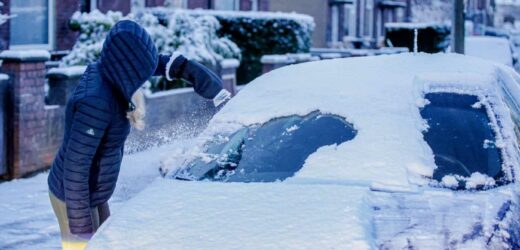
Houses in Durham were blanketed in the white stuff this morning as dog walkers waded through the snow in Northumberland first thing.
And the bone-chilling plunge has prompted fears of travel chaos as forecasters warn of dangerous conditions on the roads.
Traffic Scotland tweeted: "Heavy snowfall affecting many routes in the North this morning including the #A87#A82#A95#A9 and #A90.
"Please do take extra care when travelling."
Yellow weather warnings are in place across northern Scotland, while further warnings span over Manchester, Leeds, York, Sheffield, Carlisle and Newcastle.
In northern England, a warning of ice will be in place until 11am today.
Most read in News
ANDREW'S D-DAY Andrew’s fate up in the air TODAY as judge decides of sex assault outcome
Flight from Manchester forced to make emergency landing after 'FIRE breaks out'
TV star Igor Bodganoff dies 'from Covid' at 72 days after bug killed twin
An Asda delivery driver handed CIGARETTES to my 13-year-old daughter
Forecasters say injuries from slips and falls will be possible while untreated roads, pavements and cycle paths will also be prone to icy patches.
In Scotland, a warning of snow and ice covering Inverness and Aberdeen will be in place until 9am tomorrow.
Met Office forecasters said: "Cold northerly air dives south across the whole of the UK with brisk winds.
"It's feeling colder for all, especially in the wind."
In the capital, temperatures will plummet by 10C, from 16C at the weekend to just 6C today.
Meteorologist Simon Partridge said we're facing a "shock to the system" as the chilly winds make it feel as cold as -2C.
"It will definitely be colder, so if you're going out, think about an extra layer," he said.
"You might need anything to keep the wind out because it's not going to be pretty."
It'll only get colder as this week goes on, with towns in the south facing -4C on Thursday morning.
ARCTIC BLAST
Mr Partridge added: "It's basically what we should have for this time in January; it's just that we've been so mild for so long that it's suddenly a bit of a shock to the system."
And James Madden, forecaster for Exacta Weather, said: “There is something much more wintery on the way.
“After the very mild start to the month we expect northerly winds to return through the coming days.
“The month overall looks like dishing up something far wintrier than we have seen over the Christmas and New Year period.”
It comes after Brits frolicked in piping temperatures over the New Year weekend, when the warmest New Year's Day ever was recorded.
The baking sunshine saw highs of 16C before midday – smashing the previous record of 15.6C which was recorded in 1916.
Meanwhile, New Year's Eve was the mildest on record with 15.8C being reached at Merryfield in Somerset, and Nantwich, Cheshire.
Source: Read Full Article


