Hawaii volcano: Locals build shelters for homeless residents
When you subscribe we will use the information you provide to send you these newsletters. Sometimes they’ll include recommendations for other related newsletters or services we offer. Our Privacy Notice explains more about how we use your data, and your rights. You can unsubscribe at any time.
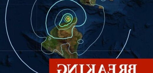
“Strong shaking” and tremors were detected just three miles (5km) north of Hawai’i – Big Island. The earthquake ruptured at a depth of about 17 miles (27km) below sea level. The Hawaiian Volcano Observatory (HVO) branch of the USGS was alerted to the quakes at 2.03pm BST on Tuesday – 3.03pm local time on Monday.
Hawai’i, or Big Island, is the biggest of the eight main islands in the Hawaiian archipelago.
The island is famous for its two famous volcanoes, Kilauea and Mauna Loa, one of which experienced a magnitude 4 earthquake early last month.
According to the HVO, today’s tremor was felt across Kohala in the northwest part of Big Island.
More than 1,200 people have already reported feeling the tremors on the USGS website.
The USGS said: “Strong shaking, with a maximum intensity of V on the Modified Mercalli Intensity Scale, has been reported across the districts of Kohala.
“At that intensity, significant damage to buildings or structures is not expected.”
The good news is the earthquake is not expected to affect Hawai’i’s active volcanoes.
According to Ken Hon, HVO Scientist-in-Charge, the tremors have had no observable impact on Kilauea or Mauna Loa.
Earthquakes like these are fairly common in the area, however, the expert has warned aftershocks are possible.
He said: “This earthquake is related to stress from the weight of the island on the underlying ocean crust and mantle.
“These earthquakes are relatively common and not directly related to volcanic processes. Please be aware that aftershocks are possible and may be felt.
“HVO continues to monitor Hawaiian volcanoes for any changes.
“The Alert Levels / Color Codes remain at ADVISORY/YELLOW for Kīlauea and Mauna Loa at this time.”
The strongest earthquake previously felt in the region was a magnitude 4.2 event on October 30, 2010.
The earthquake struck just four miles (7km) east of Kukuihaele and a depth of about 21 miles (33km)
This is a breaking story. Refresh the page to see more.
Source: Read Full Article


