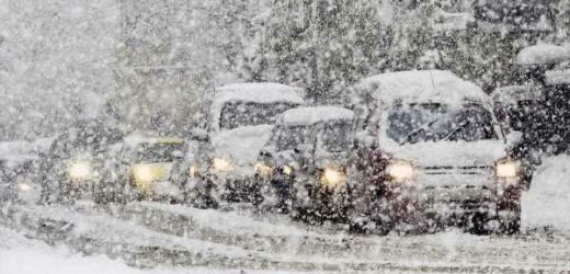
Temperatures are set to plummet to -12C in areas of the UK next week with snow possibly falling as early as this weekend in some regions.
And snowfall to rival the deluges of 2009 and 2010 is even being forecast by some meteorologists.
Scotland and northern England are expected to experience the coldest conditions but James Madden, forecaster for Exacta Weather, declared: "There is the potential for what could be a widespread snow event across large parts of the country.
READ MORE: Prince Harry referred 'livid' William to 'Google Images' during wedding beard row
"The snow is likely to hit northern regions first, but we now expect southern areas to see some snow within this period.
"This could be heavy in parts, and lead to accumulation, and this is likely to cause disruption on the roads and travel networks."
He went on to warn that strong winds threaten blizzards in parts of the country which could see a repeat of the 2010 January freeze.
"Northern England could see rain turning to snow in places from as early as this weekend and into Monday of next week," he added.
"Further, the risk is increasing of snowfall which could produce similar images to the historic snow events of 2009 and 2010."
Independent forecasters agree that temperatures will nosedive this weekend.
Weather models show a near-nationwide snow risk next week, although experts say these are likely to be overestimated.
To stay up to date with all the latest news, make sure you sign up to one of our newsletters here.
However, northern Britain, Scotland and Wales are on the hit-list with the entire country braced for the bitter bite.
Jim Dale, meteorologist for British Weather Services, said: "The cold weather will probably start to arrive from the north-west this weekend, before it really bites next week as the winds arrive from the north-west.
"As this is going to be driven by low pressure, there will be some moisture, and this will lead to wintry showers. These will be largely across the north of the country."
The cold snap will hold out through the middle of next week before the weather changes back to milder and more unsettled, he added.
"Everyone can expect to see ice and frosts and will need to scrape cars in the morning," he said.
Government forecasters have also raised the alarm, warning relentless wind and rain this week will eventually give way to colder weather.
However, the more immediate risk is from heavy downpours on drenched ground raising the flood risk.
Met Office meteorologist Alex Deakin said: "There is lots going on with further wet and windy conditions for most of us over the next few days.
"We will see some snow mixed in with the showers over the Scottish mountains, and the showers will be moving pretty rapidly because of the strength of the winds."
READ MORE:
Cone-wielding pub landlord ordered to pay taxi driver £750 after 'parking rage' attack
Fears over uranium package at Heathrow being Iran test run for new terror campaign
Prince Harry used to hear people 'debating if he was gay' on secret supermarket trips
Strip club shut after allegations '10 customers had £250k stolen when drinks were spiked'
New 'Kraken' and Omicron Covid variants feared to become dominant strains in UK
Source: Read Full Article


