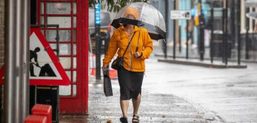
THE country is set to be lashed with blustery winds and heavy rain in coming days as an Atlantic jet stream brings an autumn blast.
But, the next 10 days will also see some calmer weather – in between the icy winds and downpours.
The Met Office said bands of heavy showers will move in from the northwest this week, and bring blustery winds, too.
Showers and longer periods of rain are expected to settle in the north today, getting heavier as the day goes on.
It will be windy, with coastal gales in the far north.
Met Office's Alex Deakin said the next few days will be dominated by low pressure to the north, and high pressure to the south.
Read more on the weather
Best thermal gloves for women to keep your hands warm in cold weather
Hosepipe ban stays until NEXT YEAR for 15million homes despite weeks of downpours
He said: “Plenty of isobars are on the charts, meaning it’s going to stay pretty blustery.
"At times we’ll see these weather fronts drifting through, bringing bands of showery rain across the country.
“Up until Saturday, we’re going to see a mixture of sunshine and showers with strong, blustery westerly winds.”
Many will be able to enjoy some drier weather on Saturday – with just a chance of showers in the north – but it won't hang around for long.
Most read in The Sun
Expected date Charles will be coronated – 70 years after Queen's coronation
Pregnant Molly-Mae Hague and Tommy Fury reveal their baby's gender
I was left with no money for weeks because my bank thought I was dead…I'm raging
Major energy firm to give thousands of customers extra £150 for winter
Alex said: “A little area of high pressure is looking to build in and bring many places and fine and dry day on Saturday.
“Sunday, however, has a few more doubts.
"That area of high pressure will be slinking off and then weather fronts and low-pressure systems – a couple of them, in fact – look to merge to bring some more unsettled weather on Sunday.
"However, there’s some uncertainty about the position, track and timing of these fronts."
He added: “What we look to be left with through next week is a similar pattern to what we’ve got now, with low pressure systems mostly to the north and areas of high pressure to the south and a reasonably active jet stream pushing everything along.”
Most read in UK News
Horror as toddler, 2, ‘falls' from high rise flats as cops rush to scene
McDonald's customer catches staff member making breakfast in 'unhygienic' way
Police swoop on mum & arrest her in front of her 4 children after ‘Twitter row’
Tributes for boy, 14, after he's stabbed to death as teen held for murder
This comes after drivers were caught in 'flash flood' chaos yesterday.
The Met Officer told the Sun Online, Llyn-y-fan in South Wales had the heaviest rainfall in the country with 68.6mm falling a 24-hour period.
Source: Read Full Article


