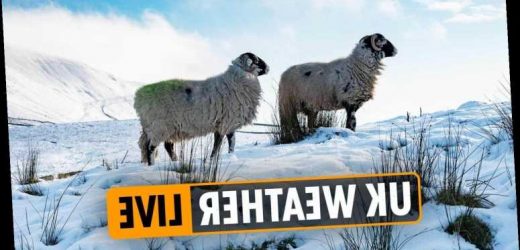
THE Met Office has issued more weather warnings for snow and ice as the infamous Beast from the East is set to batter Britain in the coming days.
A bitterly cold weather front is wrestling with La Nina – which threatens to hit the country with stormy weather.
Weather warnings are in place across vast swathes of the UK, including northern England, Northern Ireland, Scotland and along the East Coast.
Rain, sleet and snow will move south across northern England and Wales, while there will be some sunny spells in the south.
But, it will remain cold for all as thick frosts and freezing fog patches are likely.
Follow our weather live blog for all the latest news and updates from around the country…
- Katie Davis
REGIONS AFFECTED BY SNOW WARNING
The Met Office has put a yellow warning for snow in place for the following areas:
- Central, Tayside and Fife
- Grampian
- Highlands and Eilean Siar
- Orkney and Shetland
- South West Scotland, Lothian Borders
- Strathclyde
SNOW ALERT FOR SCOTLAND
The Met Office has issued a yellow weather warning for snow and ice in Scotland.
Rain, sleet and snow showers are expected to clear for much of inland Scotland this morning, and it will be dry for most of the day.
However, snow showers will then follow into northern Scotland, especially during this afternoon and evening.
A further 2-5cm is likely at low levels, with around 10cm accumulating above 200 metres.
Some roads and railways are likely to be affected, with longer journey times by road, bus and train services
REGIONS AFFECTED BY ICE WARNING
The following areas are affected by the yellow warning:
- East Midlands
- East of England
- London and the South East
- North East England
- Yorkshire and Humber
- North West England
- South West England
- Wales
- West Midlands
- Katie Davis
WEATHER WARNINGS IN FORCE
Yellow weather warnings for ice have been issued by the Met Office.
Icy surfaces may lead to difficult travel conditions.
As ground temperatures fall below freezing there is the likelihood of ice forming on some untreated surfaces.
Some of the showers may be wintry inland, but the chance of any more than isolated, very small accumulations of snow, is very low.
- Katie Davis
TODAY'S FORECAST
Rain and snow will be moving across the north of the UK today.
Early rain, sleet and snow over Scotland and Northern Ireland will be moving into northern England and North Wales, with brighter weather and wintry showers following.
Forecasters say elsewhere, it will be mostly dry, but early freezing fog patches will be slow to clear.
It will be feeling cold across the country.
- Britta Zeltmann
ICY START
A mix of rain, sleet and snow fell across Scotland and Northern Ireland last night, leading to an icy start for many this morning.
- Britta Zeltmann
SNOW AND ICE
It's set to be a chilly start today with snow and ice warnings in place across the UK.
Snow showers are expected this afternoon in northern Scotland with a further 2-5 cm of the white stuff likely at low levels and around 10 cm accumulating above 200 metres.
The snow fall should ease in Northern Ireland, probably turning back to rain this morning.
After several cold days, ice is likely to be relatively widespread on untreated surfaces and warnings are in place to take care.
The Met Office has issued snow and ice warnings across the UK today - Chris Bradford
PATCHY SNOW POSSIBLE IN THE NORTH WEST TOMORROW
As the cold weather tightens its grip, patchy snow is possible in the north-west of England on Thursday afternoon.
Skies will remain clear, leading to very cold temperatures and a thick overnight frost.
Patches of freezing fog and icy conditions are likely.
There will be a light breeze throughout and temperatures could drop to as low as -6C in rural areas.
Tomorrow afternoon will see outbreaks of light rain, snow and sleet.
- Chris Bradford
HOW TO PLAN AHEAD FOR A FLOOD?
Four flood warnings are in force in parts of Britain as a result of recent heavy rainfall and snowfall.
Parts of Kent, Norfolk, Peterborough and North Yorkshire are expected to be affected.
Here are some top tips on how you can plan ahead for flooding:
- Find out if you're at risk from flooding by entering your postcode on the Environment Agency website.
- Sign up for flood warnings – either by text, email or phone.
- Prepare a bag that includes medicines and insurance documents
- Turn off gas, water and electricity.
- Move items upstairs or to safety.
- Move family, pets, and car to safety.
- Chris Bradford
EDINBURGH FORECAST
It will remain dry and settled in the Scottish capital before rain and snow arrives in the early hours.
Much of the snowfall is expected to be light although it could settle in places.
This could increase the risk of ice.
Patchy rain and snow should clear by Thursday morning but it will stay rather chilly as temperatures are unlikely to reach 4C.
- Chris Bradford
ICE AND SNOW WARNINGS CONTINUE THURSDAY & FRIDAY
The Met Office has already issued further snow and ice warnings for most of the UK on Thursday (below) and Friday:
Credit: Met Office - Chris Bradford
IN PICTURES: BRITS PICTURED AT PRIMROSE HILL, LONDON
NINTCHDBPICT000629140870Credit: Reuters - Chris Bradford
2020: A REMARKABLE YEAR
At the start of a new year, it's often good to reflect back on the previous (in most circumstances, that is).
Figures show that 2020 was the third warmest year on record – beaten only by 2014 and 2006.
And, it was the eighth sunniest since 1919.
Professor Peter Stott, a Met Office research fellow in climate change attribution, said: "All top-ten warmest years on record for the UK have occurred since 2002, and 2020 has continued to be consistent with this pattern.
"The general trend of warming as a consequence of climate change is clearly to be seen, not just at a global level, but in our own national temperature records too."
- Chris Bradford
BEAST FROM THE EAST SNOW BOMB FEARS
Siberian winds are still pushing in from the east, with the UK expected to see more frost, ice and snow during the rest of this week.
And forecasters are now warning that a “Sudden Stratosphere Warming” (SSW) could trigger another Beast from the East next week.
The disturbance in the stratosphere can be transmitted downward, explains Phys Org.
And if this continues to the Earth’s surface, there can be a shift in the jet stream, leading to unusually cold weather across Europe and Northern Asia.
It can take a number of weeks for the signal to reach the surface, or the process may only take a few days, the website adds.
- Chris Bradford
IN PICTURES: COLD AND CRISP EVENING IN BLACKPOOL
Credit: Alamy Live News
- Chris Bradford
THURSDAY'S MET OFFICE 4CAST
- Chris Bradford
PATCHY SNOW POSSIBLE IN THE NORTH WEST TOMORROW
As the cold weather tightens its grip, patchy snow is possible in the north-west of England tomorrow.
Skies will remain clear, leading to very cold temperatures and a thick overnight frost.
Patches of freezing fog and icy conditions are likely.
There will be a light breeze throughout and temperatures could drop to as low as -6C in rural areas.
Tomorrow afternoon will see outbreaks of light rain, snow and sleet.
- Chris Bradford
TONIGHT'S FORECAST
It will be a cold and wintry evening across many parts of Britain tonight.
Showers affecting eastern England will turn icy while a widespread frost will form elsewhere.
There is a chance of a few fog patches developing throughout the night.
Rain, sleet and snow will move southeastwards across Scotland and Northern Ireland.
- Chris Bradford
THE WASHOUT THAT WAS 2020
2020 was a record breaking year as it was in the top ten for temperature and sunshine but it was also a washout.
The year was the sixth wettest since records began back in 1862.
All regions of the UK received more than their expected average rainfall with some eastern areas actually exceeding their normal December rainfall by the middle of the month.
South England and Wales received the most rainfall with Wales receiving 155% (256.2mm) and South England 162% (131mm).
Essex had its wettest December in 87 years as Cardiff had its wettest December in 72 years.
- Chris Bradford
WIDESPREAD FROST TO HIT LONDON AND SOUTH EAST
A widespread frost is set to hit London and the South East of England this evening with temperatures likely to plummet to -3C.
It will be mostly cloudy and dry overall apart from light showers near the Kent coast.
Clear spells will develop, allowing a frost to form.
Sunny spells are likely on Thursday but it will remain cold so if you're heading out, make sure you wrap up warm.
- Chris Bradford
WHAT HAPPENED WHEN THE BEAST FROM THE EAST LAST HIT THE UK?
Back in 2018, the so-called ‘Beast from the East’ hit the UK in early March after smashing into Storm Emma.
The lowest temperature recorded during that historic cold spell was -14C in Cairn Gorm in the Scottish Highlands.
At least 19 inches of snow fell on high ground.
- Chris Bradford
IN PICTURES: COPS URGE MEMBERS OF PUBLIC TO STAY OFF THE FROZEN POND IN GLASGOW
Credit: PA:Press Association - Chris Bradford
WEATHER WARNING IN PLACE ACROSS EAST COAST
A yellow weather warning for ice is in place along vast swathes of eastern Britain this evening.
Icy surfaces are expected which could lead to difficult travel conditions in places.
Showers are likely throughout Wednesday evening, before becoming confined to East Anglia.
As temperatures plummet below zero, there is the risk of ice forming on untreated surfaces.
The warning will remain in place until 10am on Thursday (January 7).
- Chris Bradford
LA NINA TRACKED IN PACIFIC
As well as the Beast from the East, meteorologists are also tracking a La Nina in the Pacific, which could bring wet and stormy weather as it increases the UK’s chances of westerly winds.
Scientists have predicted an imminent SSW over the North Pole, bringing severe consequences for jet stream and weather in the UK.
- Chris Bradford
YELLOW WARNING FOR SLEET AND SNOW IN NORTHERN IRELAND TO COME INTO FORCE
Source: Read Full Article


